Within the department of geography different bachelor thesis topics were available spanning from the field of economic geography over the fields of social geography and landscape ecology to geoinformatics and geomorphology. As I am personally deeply interested in the genesis of the landscape and the shaping processes, I decided on a topic within the field of geomorphology.
Geomorphology encompasses both the study of contemporary landforms and their evolution over long periods of time, linking it closely to the domain of geology. For the for the accurate depiction and representation of landforms, mapping skills are essential to every geomorphologist. By creating detailed maps, geomorphologists can visually analyse and interpret the relationships between various landforms, sediment patterns, and geological structures, leading to a deeper understanding of landscape evolution.
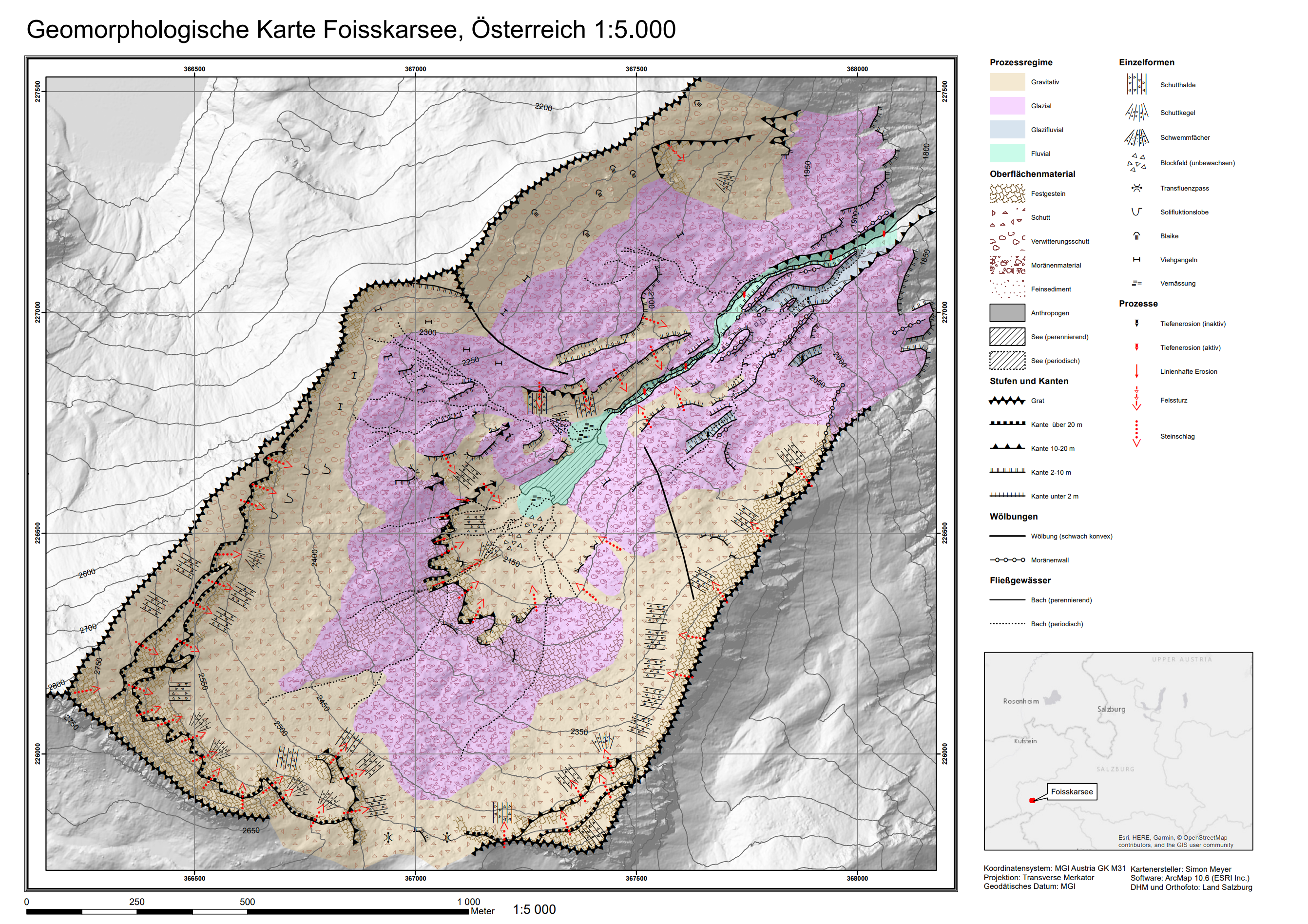
Geomorphologische Kartierung des Foisskarsee-Einzugsgebietes
Context
Geomorphological mapping is the main tool for visualising geomorphological processes. The identification and documentation of these processes is important because rapid and unforeseen changes to the Earth’s surface are often considered hazardous and are therefore of interest not only to scientists and researchers, but also to planners and emergency management. Production of geomorphological maps is generally based on a three step approach:
- Preparation of the on-site inspection.
- Inspection of the study area and initial on-site mapping.
- GIS-based mapping and creation of the final map product.
For this study, the Foisskarsee catchment was chosen, a part of the Obersulzbachtal and the national park Hohe Tauern, that had not yet been geomorphologically mapped before. Mapping was conducted in a scale of 1:5.000, based on the geomorphological legend ‚GMK Hochgebirge‘ developed by Kneisel et. al. (1998).
Results
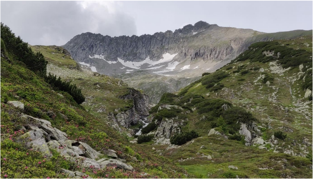
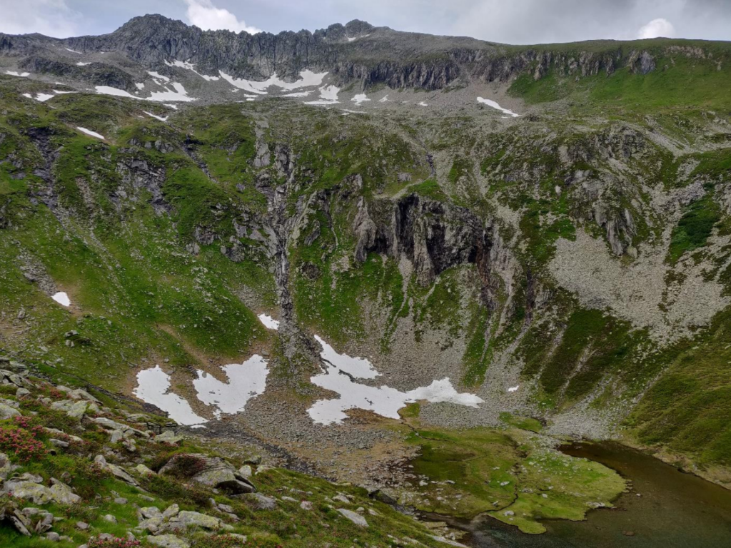
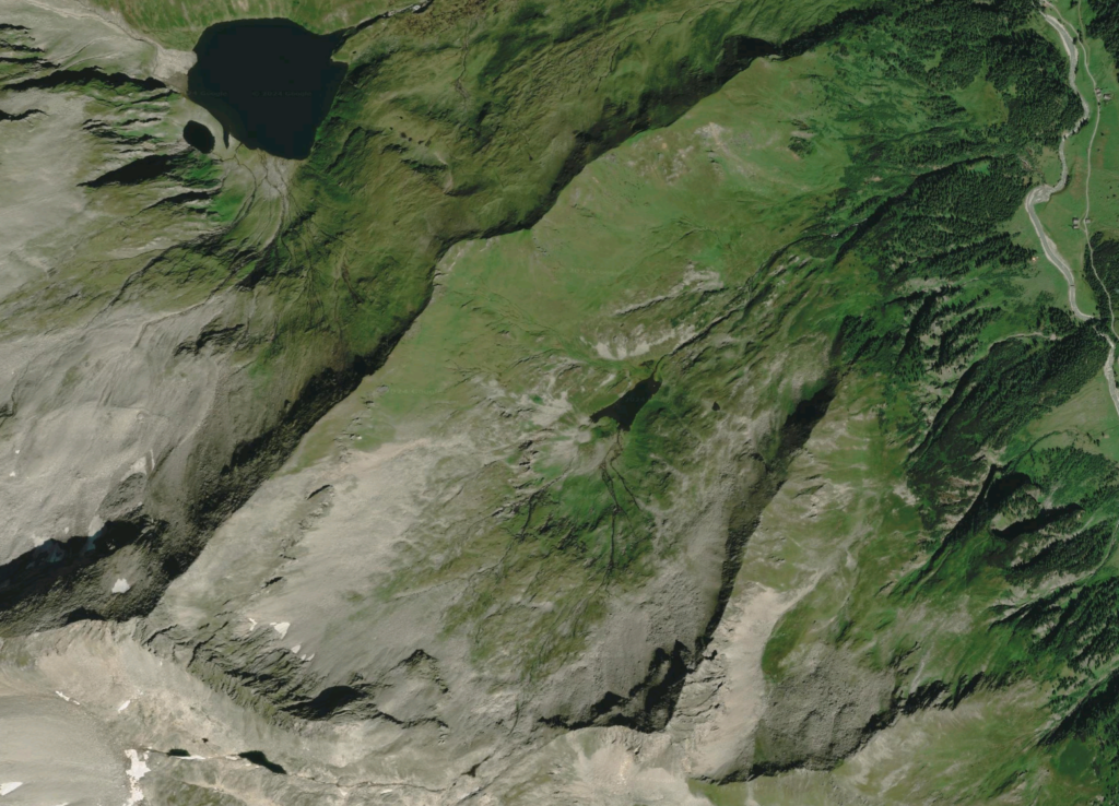
The study identified geomorphological landforms and processes of the Foisskarsee catchment and visualised them in a digital geomorphological map. The catchment’s landscape shows a complex interplay of ancient glacial forms overprinted by ongoing post-glacial, gravitational, and fluvial processes.
Glacial processes influenced the overall shape of the valley with its steep slopes, moraines, and central terrain depression created by a cirque glacier through ice pressure and erosion. The cirque basin is partially covered by materials of varying grain sizes due to advanced erosion from the surrounding slopes. Morainic deposits, though limited, are present, particularly near the cirque threshold and along some rounded hills (Rundhöcker).
Post-glacial processes that shaped the Foisskarsee catchment are divided into gravitational and fluvial processes. The steep slopes and ridges have led to significant gravitational movements, creating large debris accumulations (talus cones and scree). These are notably prevalent below the Sonntagskarkopf and in areas where older glacial forms have been overlaid by these newer deposits. The Foissbach creek, flowing from the Foisskarsee, has cut through the valley creating a clear channel through fluvial erosion. This has led to a significant incision of the streambed. Fluvial processes are limited to areas near the lake and stream, where sediment transport and deposition occur, particularly visible through small alluvial fans at stream inlets. Sediment depositions have created alluvial fans and wetlands at the northern end of the lake.
Overall, the geomorphological characteristics of the catchment are exemplary of the central alps and the Hohe Tauern region and their identification and interpretation during the course of the mapping was an interesting and very helpful exercise that helped fostering a deeper understanding of the evolution of alpine landscapes. The study also helped to improve my GIS and cartography knowledge as it required significant understanding of the software to design and change custom symbols.