The interdisciplinary project ‚Application Development‘ was a group project of up to three students aimed at incorporating the gained knowledge in software development, spatial analysis skills, and project management to create a new geo-application. The course was split in two parts. The first part was dedicated to develop a mobile web app using geo-browser APIs, while the second part was dedicated to develop geo-processing applications using Python and ArcGIS. In total two major applications were developed within the course, one custom web map and one ArcGIS Notebook containing a guide for a wind farm suitability analysis.
Custom Web Map
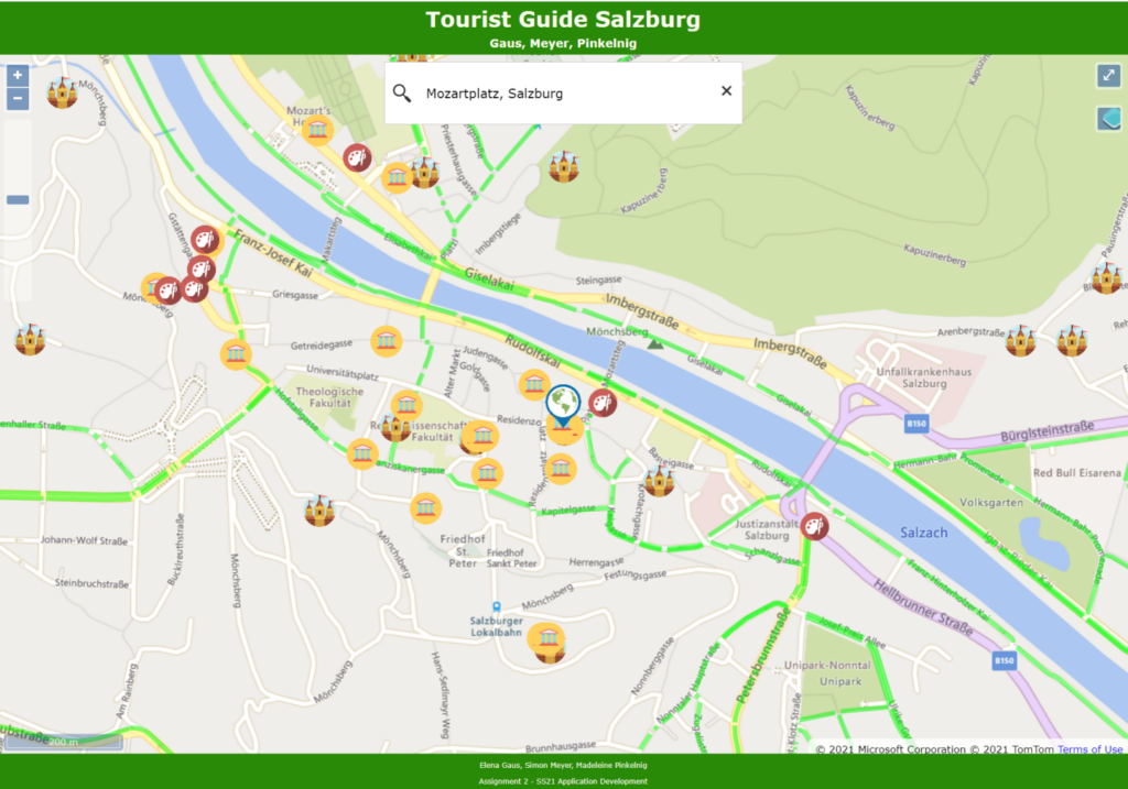
In this project a viewer-friendly tour guide to Salzburg and Salzburg surroundings was built. The aim of this map was to give tourists an easy to use tool to showcase potentially interesting spots near them. For that task datasets of tourist attractions such as museums were placed on the map and routes connecting the destinations were added to guide the users to their location of interest.

Wind Farm Analysis
The second application was aimed at detecting potential areas for wind farms in the state of Lower Austria. This suitability analysis was based on a multicriteria decision making process that limits the potential areas in several steps until the perfect region is found. The application was developed using ArcGIS Notebooks with Python, making it easy to adjust parameters and change settings as well as share and collaborate workflow and code.
The suitability analysis for wind parks was conducted in three major steps.
The first step was to retrieve the basic datasets containing the areas in which wind parks are prohibited such as settlement areas, nature reserves and areas with special conservation status or valuable land. This step was conducted by Elena Gaus using ArcGIS Online Notebooks. The second step of the suitability analysis was the implementation of a multi-criteria decision analysis that was done by Madeleine Pinkelnig using raster tools in ArcGIS Pro. The last step of the suitability analysis contained a visibility analysis of the potential wind park areas. The visual impact analysis was conducted by me again in ArcGIS Pro.
