The master’s thesis as part of the applied geoinformatics studies programme aimed to provide the first extended scientific project. Within the department of geoinformatics (Z_GIS) different thesis ideas were provided spanning from projects in earth observation and image analysis over mobility studies to spatial modelling. While many different topic ideas were provided, I decided on my own topic.
A few months earlier I had tried to manually vectorize a historic map to be able to assess land cover changes. The tedious manual work made me question if there are ways to automate at least some of the work. I remembered the supervised classification approaches used for the vectorization of satellite imagery and asked myself if this would be applicable to scanned historic maps as well. Some time passed and a bit of research later I decided to try to adapt the satellite image analysis workflows to the analysis of historic maps.
Extracting Land Use and Land Cover Information from the Franciscean Cadastre using Object-Based Image Analysis and Convolutional Neural Networks
Context
Since the onset of the industrialisation in the early 19th century, land use and land cover (LULC) in the province of Salzburg has changed significantly. The documentation and visualisation of this change through long-term studies is important for the evaluation of landscape changes and the core of many often interdisciplinary studies.
The greatest obstacle to analysing long-term landscape change to date is the limited availability of comprehensive historical data sets. While today many geographic datasets are available, they are overwhelmingly restricted to recent timeframes and rarely older than 50 years. A proven method to extend timeframes is to utilize historic maps, but manual map vectorization is time consuming and prone to errors which has so far limited their application in the amount of vectorized historic data.
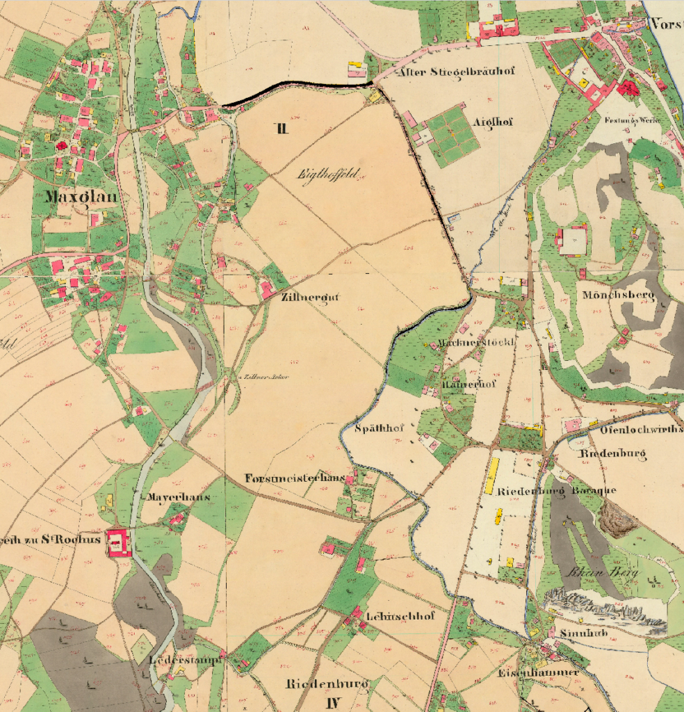
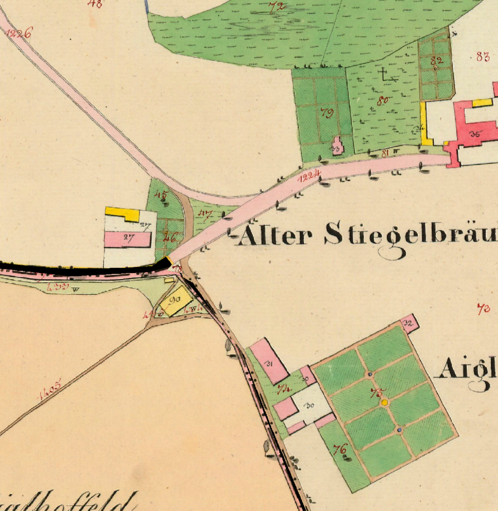
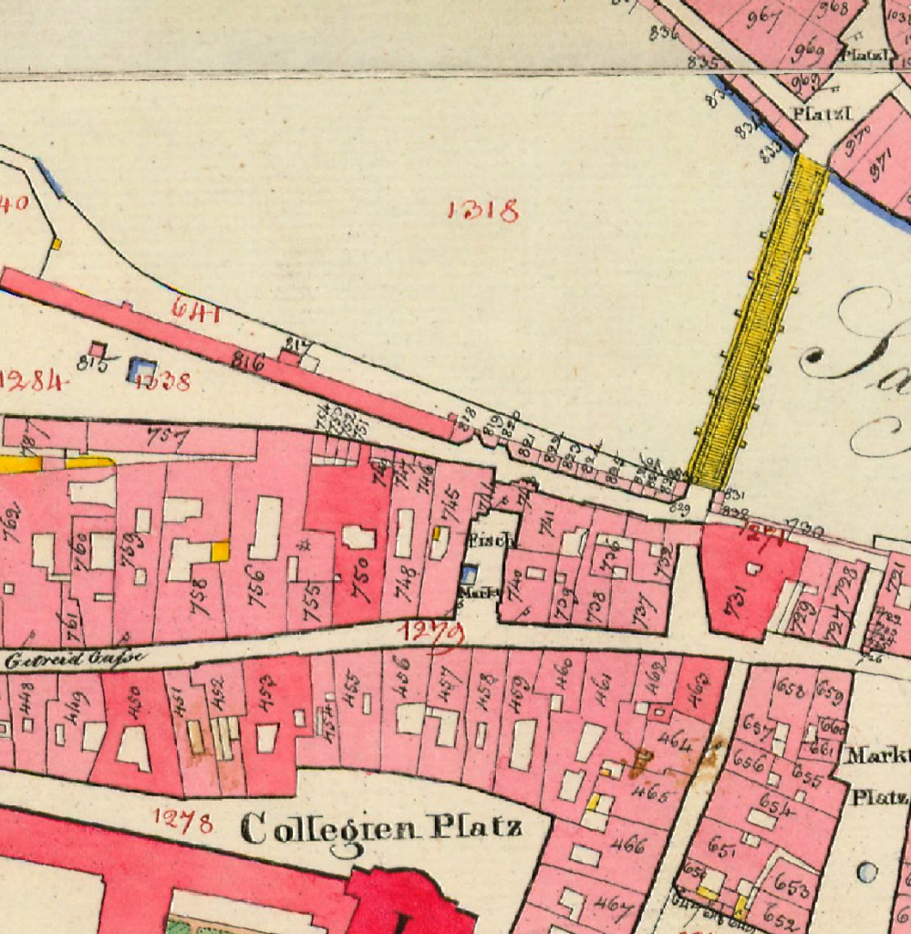
Today it provides valuable insights in the past landscape, which are rare in this detail. Coincidentally, it also depicts the landscape during the great surveying work of the Franciscean Cadastre, one of the most famous large-scale mappings of the early 19th century.
Results
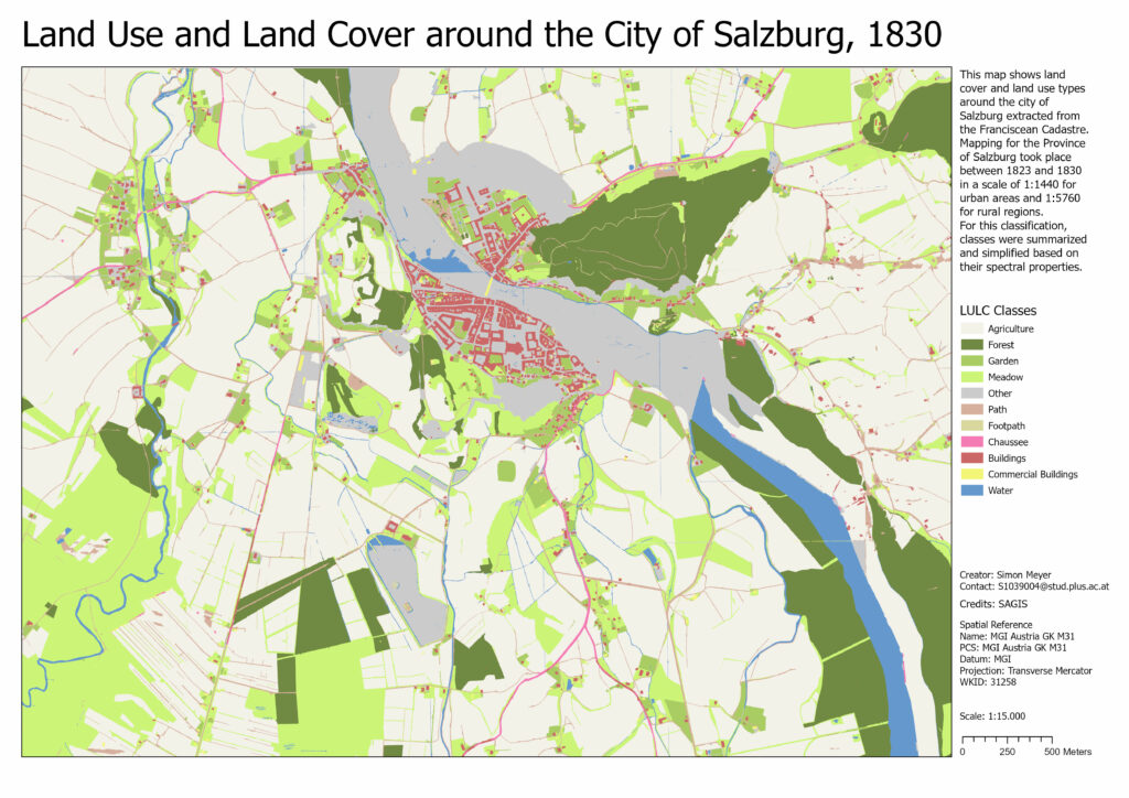
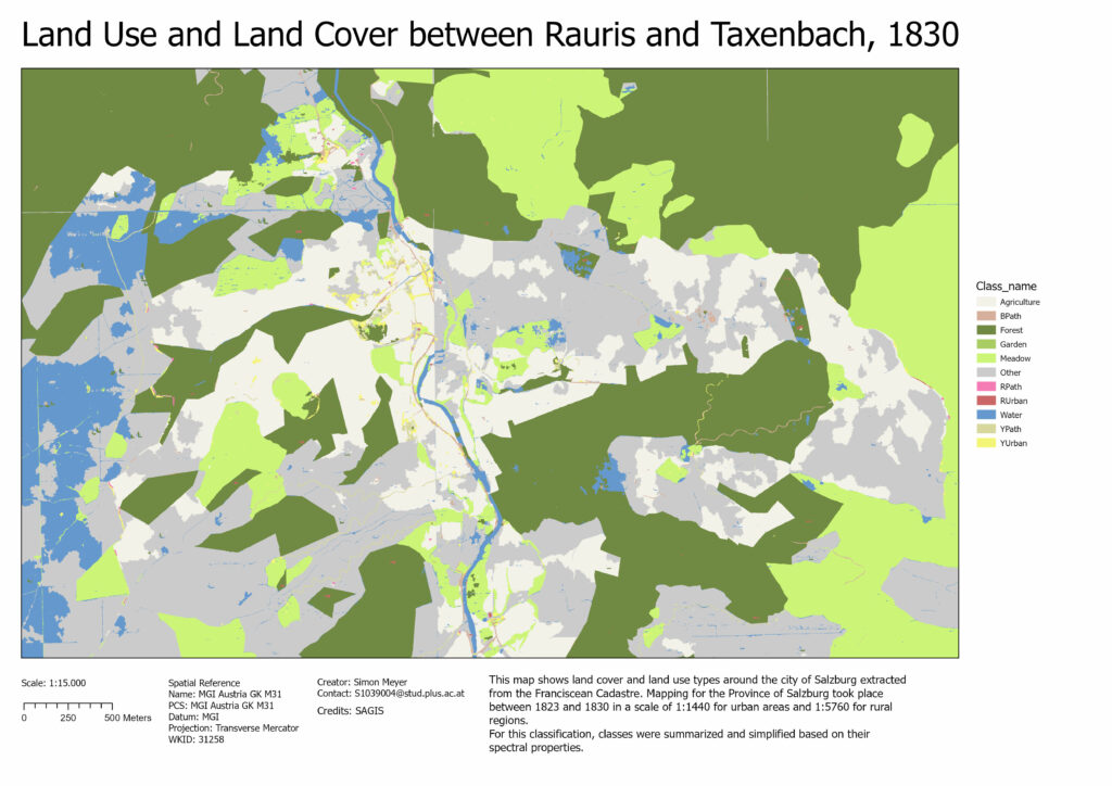
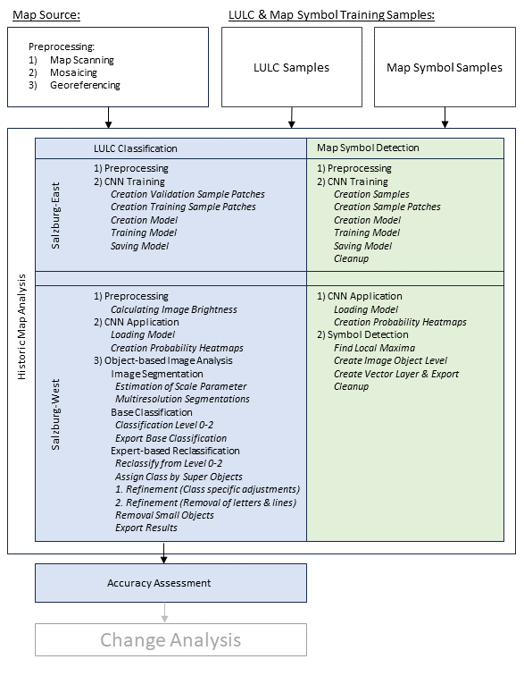
This study aimed at developing a workflow in Trimble eCognition for a semiautomatic extraction of geographic information from scanned maps using object-based image analysis and convolutional neural networks to classify and vectorize historic maps. The focus was set on the extraction of selected map symbols and LULC classes from one of the most important historic map series of Austrian Empire, the Franciscean Cadastre (Franziszeischer Kataster). Results of this study should provide the foundation for potential large scale vectorization work of the cadastre and enable the quantitative analysis of the historic landscape and its transformation over 200 years.
The scanned and georeferenced images of the cadastre were kindly provided by the spatial data infrastructure department of the federal state of Salzburg.
Image analysis was split into two parts, the segmentation and classification of LULC, and the recognition of map symbols. For both workflows, individual CNN classification models were trained. The LULC classification approach was based on the OBIA paradigm where the image was segmented first, and then classified. To improve the classification result and improve the overall accuracy, an expert-based reclassification approach was added, which also handled the removal of cartographic symbols, letters, and lines from the final classification.
Result

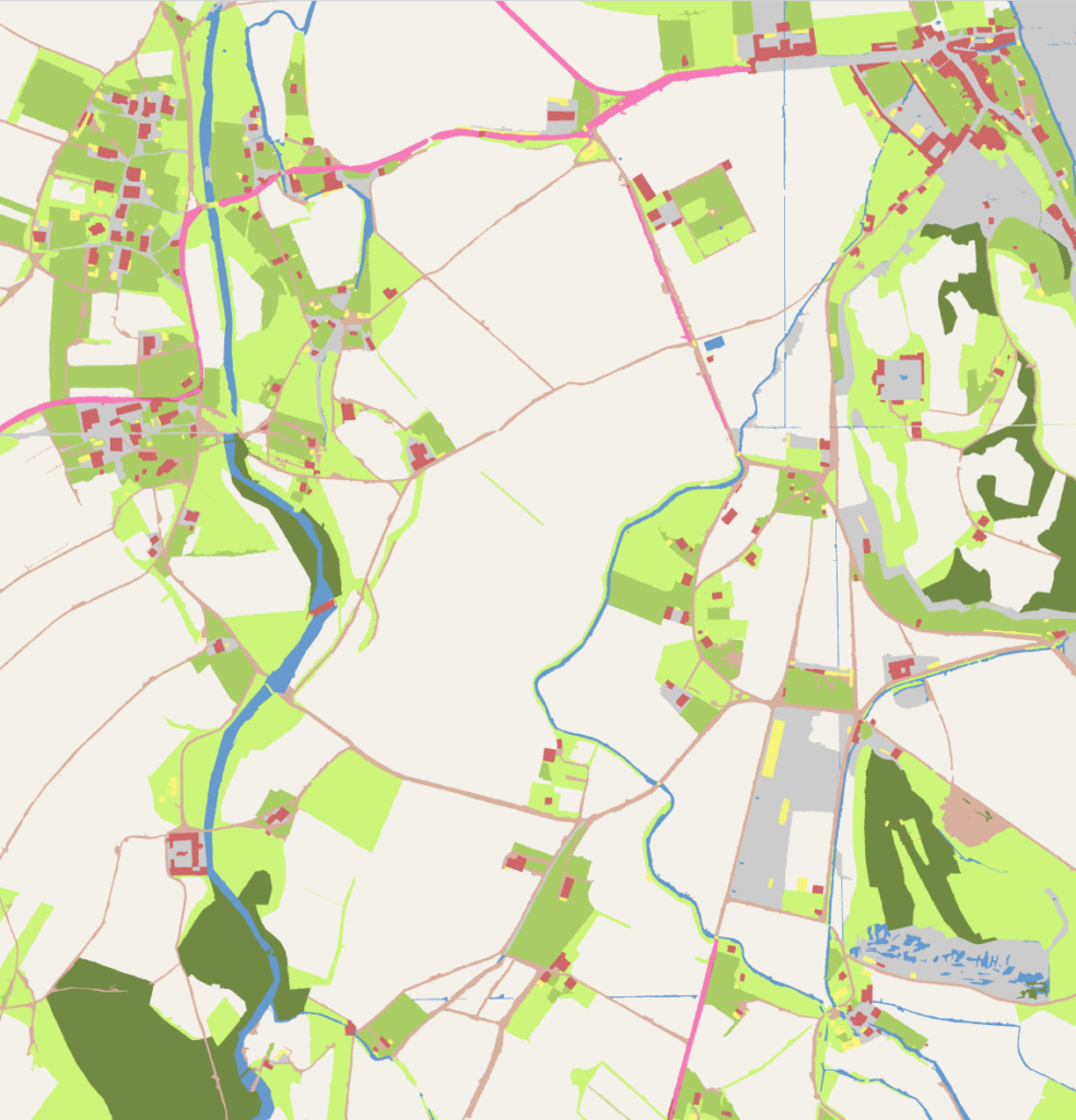
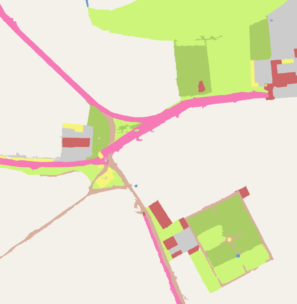
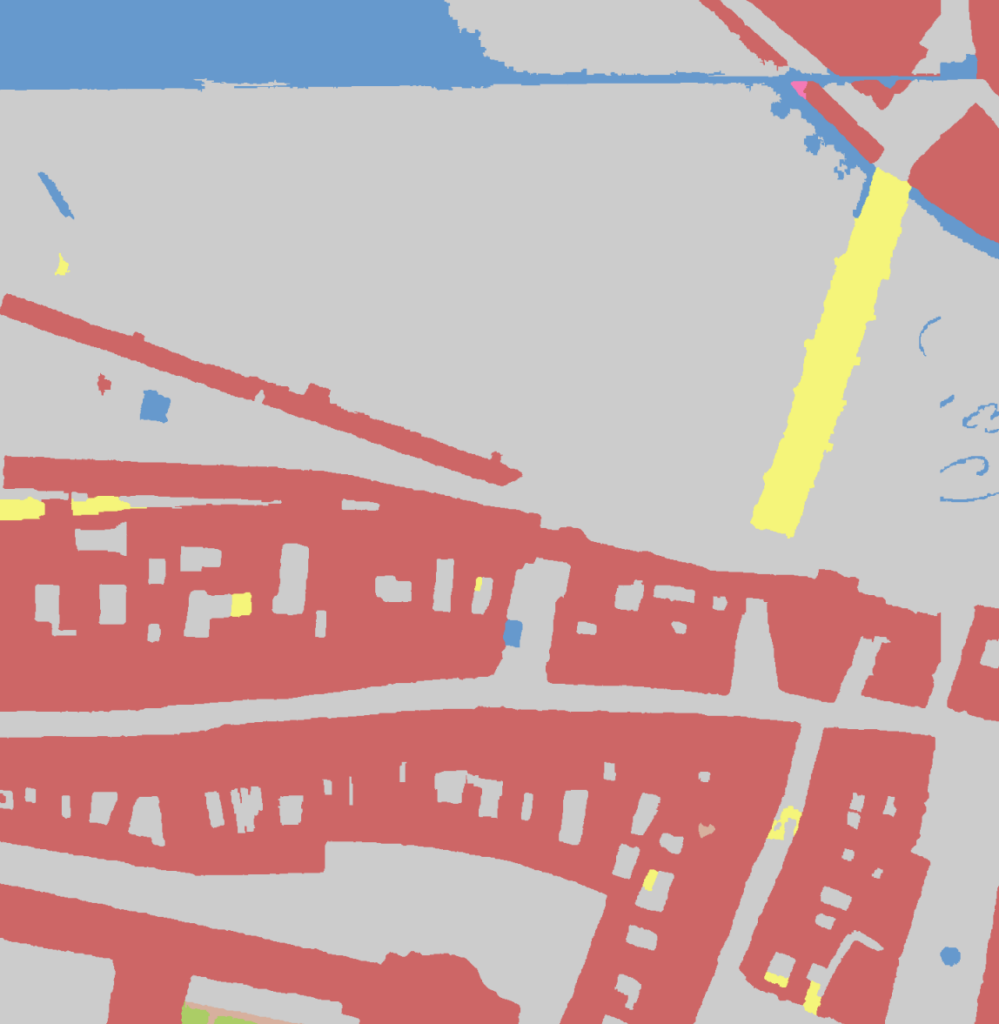
While the goals of the study were ambitious, not all objectives could be achieved. Map symbols could not be recognized with sufficient accuracy. Therefore, they were not included in the LULC classification. The surface classification achieved a 90% overall accuracy for the Salzburg region with varying accuracies per class. The overall classification accuracy dropped significantly in the second study area located in the High Tauern region, indicating a limited ability of the classification approach to correctly classify severely degraded map sections. Further work in training and parameterization is required to ensure transferability in other regions of Salzburg. Despite these limitations, the study represents a step forward in making historical geographic data available for spatial analysis and may lay the groundwork for future studies that expand the dataset geographically.