The introductory course ‚Advanced Remote Sensing‘ was centred around learning new and more in-depth content in the field of remote sensing as well as applying said skills in selected software environments.
The course covered the full workflow from image acquisition to image (pre-)processing and classification to the final product and quality assessment. Each session included hands-on exercises and assignments that were included into the final grading.
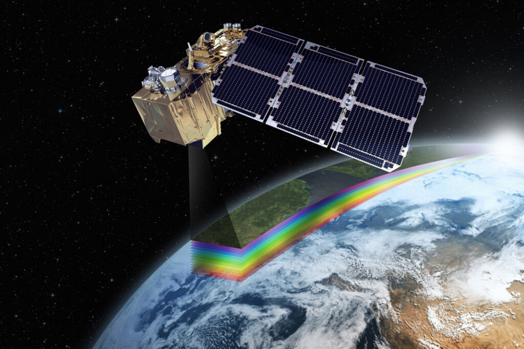
Key objectives of the course were to increase the understanding of the larger space policy context of earth observation, especially in the context of the European earth observation programme Copernicus, to familiarize with advanced methods, tools and techniques of remotely sensed imagery. Additionally, the course aimed to help familiarize with commonly used image analysis tools and methods and to be able to tackle ‚real-world‘ application scenarios, apply specific image acquisition techniques (VHR optical data, RADAR data, LiDAR, UAV etc.). Within the course important remote sensing approaches were introduced, including image pre-processing (calibration, filtering, and pre-classification) and spatial image analysis using image segmentation and advanced classifiers (both physical-model based and statistical), including object-based image analysis techniques.
Practical Example: UAV Analysis
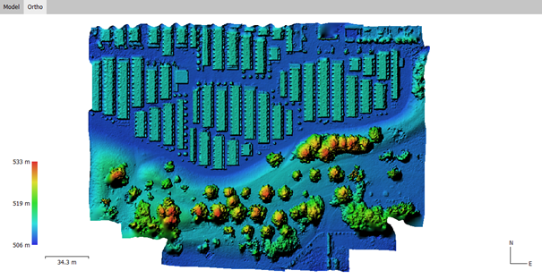
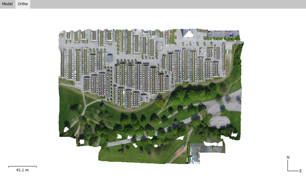
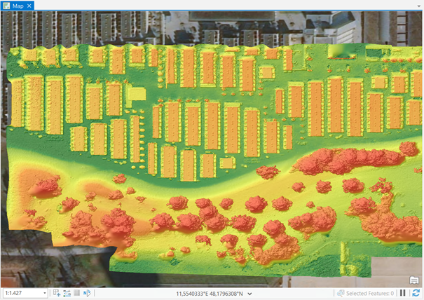
The UAV Analysis assignment was centred around the processing of UAV images taken from the Olympic village in Munich, Germany. The software used for processing the images was Agisoft Metashape, a photogrammetry software used for image processing.
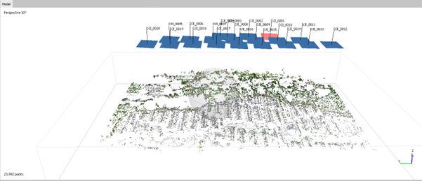
The assignment did contain all relevant steps from the creation of a point cloud from the reference images to the creation of ground control points to increase the accuracy of the derived products and finally digital elevation models and image mosaics.
Practical Example: Image Segmentation
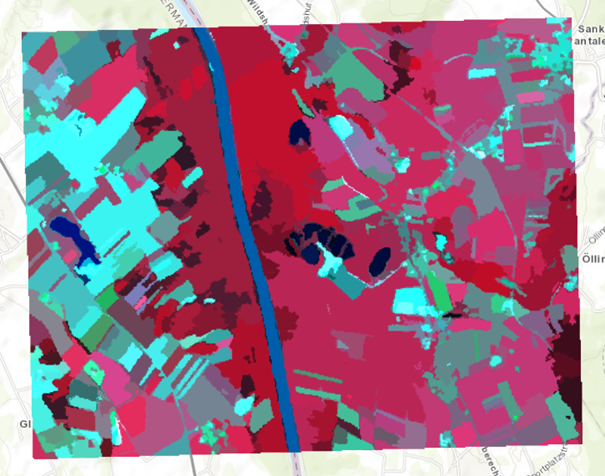
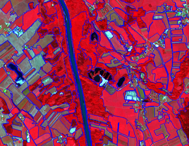
The image segmentation assignment was centred around introducing different image segmentation strategies and algorithms. For the segmentation ArcGIS Pro and eCognition Developer were used, both have various segmentation tools available.
In the assignment two different segmentation algorithms were introduced, Mean Shift Segmentation (in ArcGIS Pro) and Multiresolution Segmentation (in eCognition Developer). Both algorithms were applied to the same reference image, a Spot-5 false-colour infrared image covering a section south of Salzburg. Different parameters were tested to show the changes between each parameter. Finally, the two techniques were compared and a short report was written.
Practical Example: Image Classification
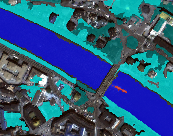
The image classification assignment focused on introducing advanced concepts of image classification, including object-based image analysis which in difference to other most supervised classification techniques includes a rule-based modelling approach. Example was a image subset of the city centre of Salzburg, Austria that contains a part of the river Salzach. The goal was to successfully extract selected objects and land cover types from the image. For this task different algorithms were used, including a chessboard segmentation and multiresolution segmentation to segment the image. NDVI indices were created to differentiate different types of vegetation and water and classification algorithms were applied to create the desired classes. The final results were presented in a short report.


Practical Example: RADAR Analysis
The RADAR analysis assignment was centred around introducing concepts of RADAR image analysis to the course participants. Different antenna expositions of the system (VV, VH) were discussed and explored in a practical example to show the differences on various land use and land cover types. Results were again presented in a short report.

Final Assignment
At the end of the semester the course was ended with a final assignment that did include the segmentation and classification of a new image in the eCognition Developer software. The final evaluation of the course was based on the individual assignments and the final exam.
In conclusion the course helped introducing more advanced concepts and theories to the course participants. Different stages of within the workflow of image analysis were illuminated. Especially the introduction into RADAR analysis was interesting as it was not a main focus in other courses available in the master’s programme.